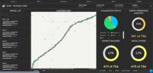
In November of 2014, the state of West Virginia enacted the “Above Ground Storage Tank Act,” which required inspection and certification of all above ground tanks. In response, Dawood assembled a multi-disciplinary approach to complete 1,600 inspections for a client by December 31, 2014. To complete this task, Dawood created an online Geographic Information System (GIS) project management tool that served as an interface to visualize and track the data collection and monitor progress. To expedite data collection, Dawood created a Global Positioning Information (GPS) based checklist for field crews to upload the geo-referenced data daily. Hosting the data in a GIS platform enabled Dawood to automate figure generation, creating over 1,000 figures dynamically from one map document. This accelerated quality control reviews and offered real-time access to data collection efforts for the client that allowed for more efficient review and certification.


