
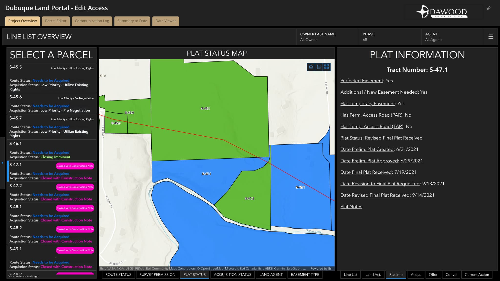
Senior Geospatial Specialist Tim Woodfield, GISP, Advances GIS Innovation and Industry Leadership
Tim Woodfield, GISP, blends hands-on expertise with a passion for data-driven storytelling and a career rooted in


Tim Woodfield, GISP, blends hands-on expertise with a passion for data-driven storytelling and a career rooted in
Timothy Woodfield, GISP, thrives in his role as trusted client advisor. Lead Developer for Dawood’s 2022 Esri
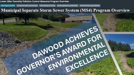
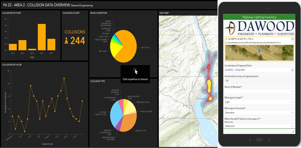
Harrisburg, PA: Dawood created geographic information systems (GIS)-based survey tools and a water quality Story Map for