
Part One | Part Two
Sam Lamport shines at Dawood! Armed with a strong academic foundation in biology, he evaluates and characterizes natural resources during development projects. We sat down with Sam for a snapshot of his day and how he drives our efforts towards greener land management.
Talk about your recent project experience.
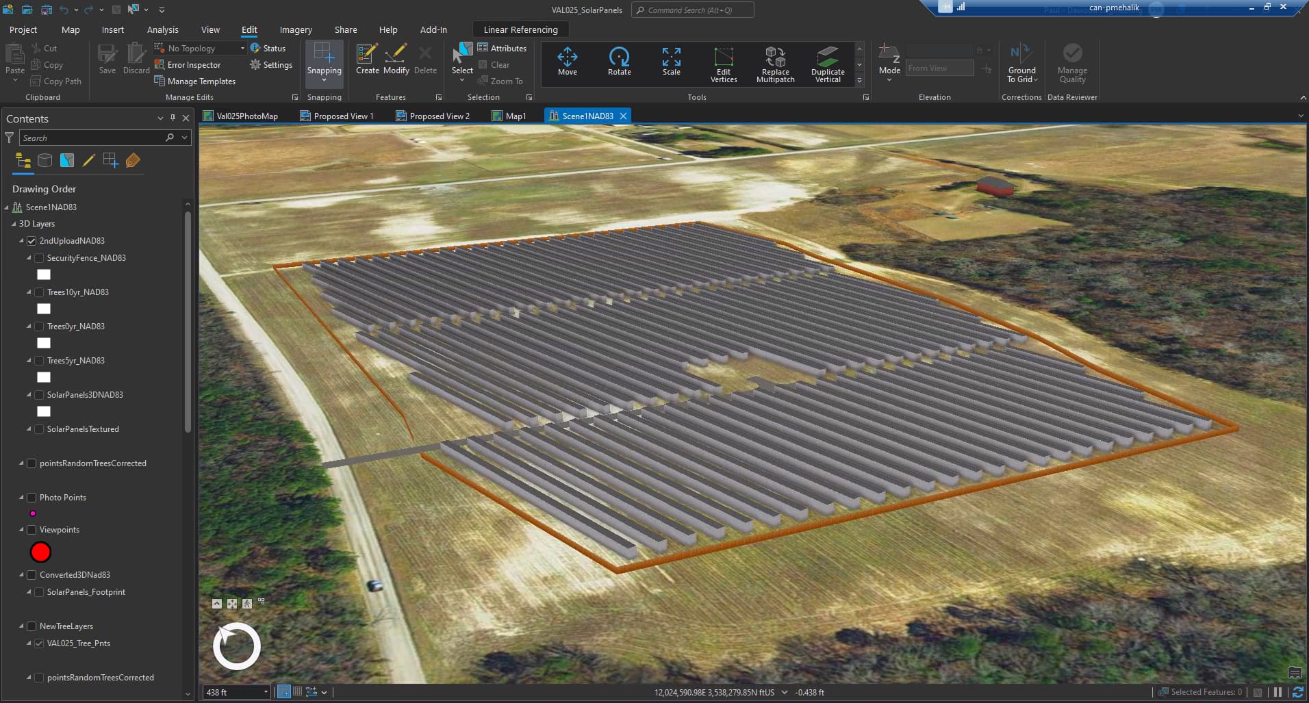
Our team provided a wetland delineation report for a Mid-Atlantic client, as part of a project proposing to convert reclaimed sand and stone quarry land into a 1,530 kilowatt-per-hour bifacial solar panel site. I assisted senior staff to identify and delineate wetland boundaries, where we analyzed the site by digging test pits, searching for signs of water, and identifying wetland plant species.
How was technology involved?
Our team located the transition zone between wetlands and uplands, flagged the wetland perimeter, and used an Eos Arrow backpack GPS unit to provide accurate boundary mapping. The GPS unit automatically uploaded coordinates in ArcGIS software for office employees to review in real-time. Watch our related ArcGIS video showcasing the solar site.
How do you incorporate site assessments into your projects?
In addition to field delineation, Phase I ESA services minimize hazards and protect workers during eventual construction activities. For a large site with an abandoned residence, we investigated public databases and regulatory files and conducted interviews and site reconnaissance to evaluate the potential presence of storage tanks and hazardous materials. Our team’s due diligence identified heating oil tanks and ensured the developer properly disposed of them before demolition.
What are your future goals?
Earning my wetland professional in training (WPIT) licensure tees me up for my professional wetland scientist (PWS) credential and International Society of Wetland Scientists membership.