Located in Dawood’s Częstochowa, Poland, office, ArchiTube Surveyor Adam Rak is laser focused on scanning, photogrammetry, and geodesy assignments. As an AGH-UST student, Adam achieved his Master of Science in geoinformatics and engineer’s degree in geography and cartography. During this past year with ArchiTube, he continues to evolve his skillset.
Talk about your career trajectory.
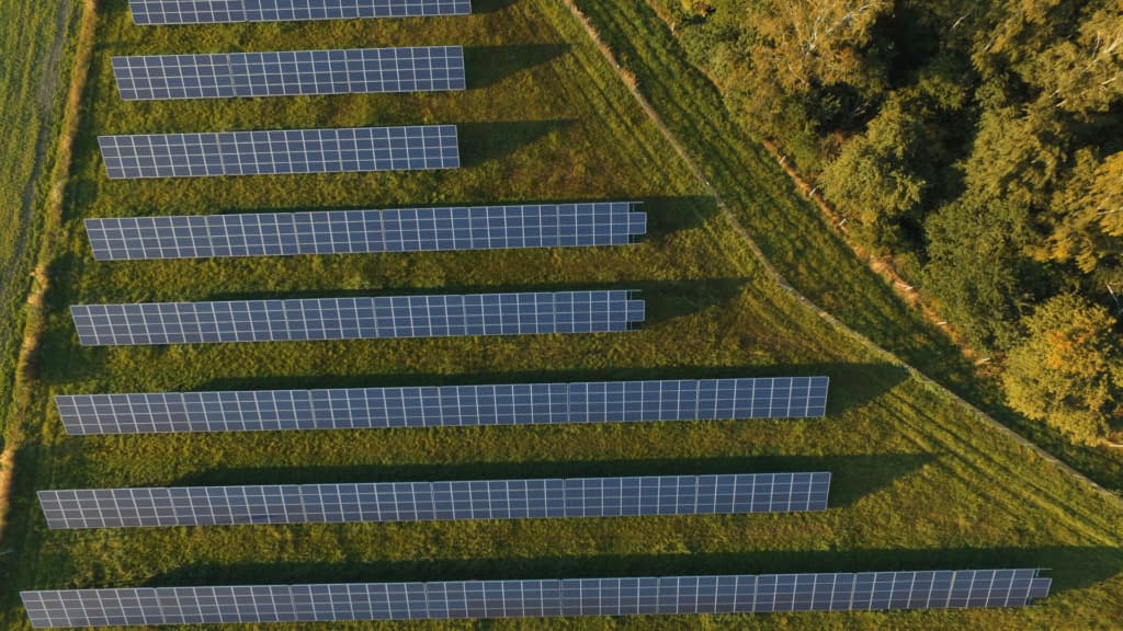
Although I joined the ArchiTube team in January 2023 to work on building information modeling (BIM)-related projects, my expertise in Geodesy and Cartography at the University of Science and Technology in Kraków led me to focus on photovoltaic farm projects. These solar assignments are important for the environment, allowing our company to contribute to a brighter future using renewable energy technologies.

How does your experience align?
These projects require multiple skills such as proficiency in photogrammetry and CAD software and proper eligibility such as drone operator—an area where I am certified. Adaptability and willingness to travel throughout the region to various sites is important. I don’t have typical day-to-day work, which I enjoy.
What are your responsibilities?
Most often, my day begins by preparing surveying materials then planning a trip to the solar project site. The duration of my stay mainly depends on the size of the photovoltaic farm as well as the distance from our office. For the most part, a project trip lasts a maximum of three days.
At the project site, I utilize a drone with an RTK module—providing highly accurate and real-time positioning data by using a combination of GPS signals and reference station correction data. This setup allows me to capture aerial imagery essential for creating detailed 3D BIM models.

Describe project conditions.
Most solar farms typically cover 10 to 30 hectares. Correct data processing requires a long walk to establish the ground control points, which is not a straightforward task. Drones are good on open landscapes without vegetation to avoid disrupting model accuracy.
In wooded and overgrown areas, I conduct measurements using classic geodetic techniques. During fieldwork, I also update the geodetic map obtained from the local geodetic center—a crucial step to acquire appropriate construction permits.
Once back in the office, then what?
I engage in data analysis and processing. Since photogrammetry images are used to generate point clouds and, subsequently, terrain models, I often use various techniques to achieve a cohesive result.
My processes encompass photography and traditional measurements, as well as current online databases. I additionally create orthophotomaps and interactive 3D models—beneficial tools for solar project investors.
Can you share an example?
I’ve also uploaded low-resolution model to a popular website that allows viewing 3D models to illustrate what a basic project site looks like. Of course, this example is just a summary.

Working on solar photovoltaic farms is much more complex! From both an integrated geospatial technologies perspective and engineering know-how, ArchiTube and Dawood provide our solar partners and investors with a solid understanding of the renewable energy project lifecycle. Learn more.
Your vision for the future would be. . .
At ArchiTube, my goal is to develop my skills to eventually manage a department created specifically for renewable energy projects. I hope that in the near term, I’ll be able to participate in projecting photovoltaic farms by expanding our scope to include photovoltaic panel layout design based on GIS analysis.
I’m grateful for the opportunity to contribute on photovoltaic farm project initiatives, which build a better future free from environmental pollution.

